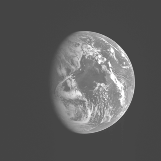
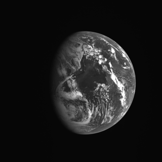
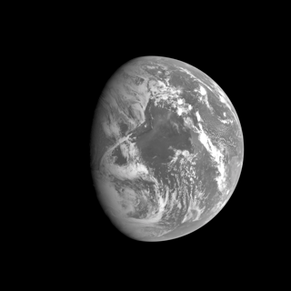
So unless you’re using OS X (or, apparently, Firefox 3.5b4 on Vista), my earlier article and MDIS and embedded colour profiles and what-not must’ve seemed a little bit mysterious. The two pictures of Earth will have looked the same (on computers that ignore the ICC profile embedded in the PNG).
It turns out that Apple’s ColorSync Utility will let you change an image’s ICC profile: either editing the image to fit the new profile, or just slapping a different profile on (I discovered this by reading the Help, making it the second useful fact I’ve learnt from OS X Help). Strangely, ColorSync can also resize an image. And it’s a magnification tool. Anyway, remapping the images into sRGB allows me to show you a simulated version of what I see. Your computer will ignore the embedded sRGB profile, but that’ll be okay, because it’ll look roughly right. That’s what sRGB is designed to do.
The top image is a simulation of the raw MDIS camera values in a linear space. The bottom image is the corrected version using the ICC profile I showed in the earlier article.
The middle image is the “just blat the pixels onto the graphics card” version that ignores all gamma and ICC profiles. As you can see, in terms of black level, it’s hard to distinguish its background from your display’s true black unless you put a true black right next to it.
PS This is supposed to be Earth. Does anyone recognise what we’re looking at? Technically there’s enough metadata in the original IMG files for me to answer that question, since the exact time of the exposure is recorded as well as exactly where the camera was pointing, but like that’s going to happen.


2009-05-08 at 10:09:28
If you can tell us when it was taken, we can easily do it from that.
Without that information, well, we’re near the equinox so the terminator is near-as-dammit north-south. The big dark area is ocean, for sure (although you didn’t say what wavelength the image is filtered at). Um.
2009-05-08 at 10:46:19
For once the metadata is in plaintext. Check the first 8192 bytes of the IMG file I linked to earlier.
I believe the parameters you are after are:
START_TIME = 2005-08-02T13:48:10.566121
STOP_TIME = 2005-08-02T13:48:10.813121
(the start and stop times of the exposure). UTC? who knows.
Also, the spectral characteristics:
CENTER_FILTER_WAVELENGTH = 479.9 <NM>
BANDWIDTH = 10.1 <NM>
We can see from this metadata:
MESS:FW_GOAL = 6492
MESS:FW_POS = 6540
MESS:FW_READ = 6540
that the filter wheel (FW) is not positioned exactly on its goal position. There really is a lot of metadata.
The section of metadata labelled “SPACECRAFT POSITION WITH RESPECT TO CENTRAL BODY” in fact gives its location in Earth-centric coordinates (that being the central body du jour). And it’s…
2009-05-08 at 12:22:21
So if it’s in UTC we’re looking at the Atlantic?
2009-05-08 at 13:23:03
See also http://rapidfire.sci.gsfc.nasa.gov/realtime/2005214/ for lots of earth imagery from that date.
Do we reckon North is at the top, so that’s the sunrise terminator?